QField is an application for collecting field data via an Android device. It was started 4-5 years ago by the Swiss company OPENGIS.ch LLC which also employs several core QGIS developers. QField has reached the point where it rivals most data collection apps. The only reason we have not been using it for Community Health Mapping workshops is that it is not available for iOS. This is simply because the open source license used by QField does not allow it to be wrapped into a proprietary software license like the one Apple employs for it's store. If however, you are a Community Health Mapper who uses Android it is a fantastic choice.NOTE: It is possible to set up an app which is compatible with iOS but does not participate in the App Store. This solves the licensing issue. Setting up an app this way necessitates becoming part of the iOS Enterprise Program which costs money. QField developers would like to make this happen, and it will likely involve iOS users donating to QField. Although QField is rooted in QGIS code it is not a miniature version of QGIS. Rather it is a streamlined data collection app. As they say, "the buttons are few and they are large," so you can work with it out in the field. QField lets you create a map in QGIS and upload that map to your mobile device. From there you can collect data.The workflow for QField looks like this. You begin by making a QGIS project on your computer. Importantly this project will contain the point, line or polygon layer(s) you want to populate in the field. (NOTE that Fulcrum only allows the collection of points!) This means you think of your survey form and data to be collected in the office, and create fields in your GIS layer(s) for each question you want to answer. With a little bit of QGIS editing familiarity this isn't any more difficult or time consuming than creating a form in Fulcrum. You then upload the folder containing the QGIS project and data to your mobile device. The GeoPackage data format, which is the default for QGIS 3.x, works great with QField. There is even a QGIS Plugin named QFieldSync that facilitates migrating your project to your device. Once the data has been copied to your mobile device you can open your QGIS map file using QField.
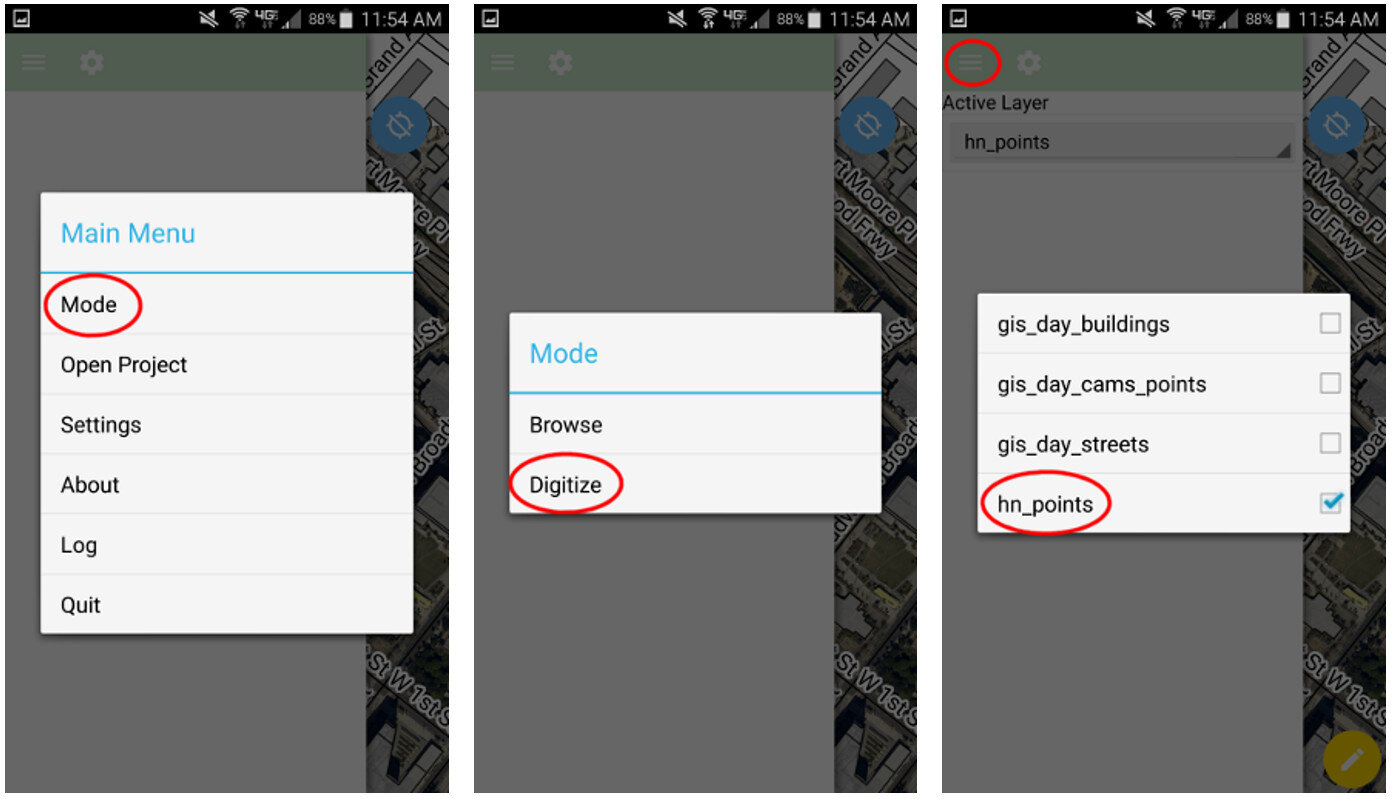 QField uses the same rendering engine as QGIS so the map will look identical to how it did in the office. Once the map is open you can select from one of two modes: Browse or Digitize. When collecting data you would choose Digitize. Then select the layer you want to work with.
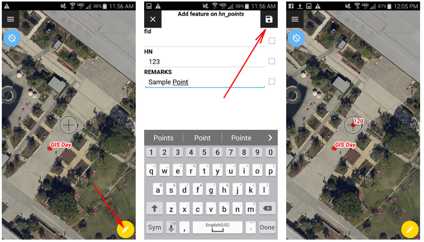 For public health officials with security concerns QField is a great fit because there is no third party cloud platform involved. The data is not being streamed across the internet. All the data is stored locally on your mobile device. You can simply use the My Files app on your device to navigate to your GeoPackage file and email it to yourself. If it is too large you can connect your device to you computer to download it or use a data sharing app such as DropBox or Google Drive.Since this is an open source project you can request new features and report any bugs you encounter by contacting the developers! Since QField doesn't cost anything to download and use, you can also consider donating to the project to help it continue. Even small donations are helpful to projects like this. Doing this makes QField better for everyone. I encourage you to try it out.